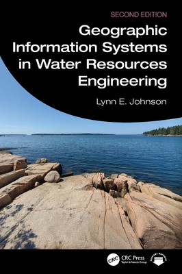
Geographic Information Systems in Water Resources Engineering
暫譯: 水資源工程中的地理資訊系統
Johnson, Lynn E.
- 出版商: CRC
- 出版日期: 2026-06-24
- 售價: $6,290
- 貴賓價: 9.5 折 $5,975
- 語言: 英文
- 頁數: 358
- 裝訂: Hardcover - also called cloth, retail trade, or trade
- ISBN: 1032973447
- ISBN-13: 9781032973449
-
相關分類:
地理資訊系統 Gis
海外代購書籍(需單獨結帳)
相關主題

商品描述
The second edition of Geographic Information Systems in Water Resources Engineering, thoroughly revised and updated, presents a comprehensive review of the concepts and applications of GIS in various scenarios from surface water and groundwater to wastewater and river basin planning. State-of-the-art GIS spatial data management and analysis tools are revolutionizing the field of water resources engineering, so familiarity with these technologies is now a prerequisite for success in engineers' and planners' efforts to create reliable infrastructure. This book develops a broad-spectrum understanding of the nature of GIS and how it is used to create, analyze, and incorporate geographic data into water resources engineering practices.
New in the Second Edition:
- New GIS technologies and methods used in water engineering domains such as remote sensing for surface and groundwater monitoring and integration of high-resolution land use and property data.
- A new chapter on GIS Management for Water Resources includes GIS planning and implementation approaches, and financial analysis of benefits and costs.
- New case studies describing applications of GIS for water resources monitoring, assessments, and decision making.
- Incorporation of content and discussion regarding advances in applications of artificial intelligence in GIS technologies and methods.
This book is intended for water resources professionals, managers, and researchers who are seeking updated information on geospatial techniques and technologies to guide their modeling approaches and applications. It is also an excellent resource for senior undergraduate and graduate students taking courses that cover topics such as water resources, watershed management, water quality, advanced spatial and GIS modeling.
商品描述(中文翻譯)
第二版的《水資源工程中的地理資訊系統》(Geographic Information Systems in Water Resources Engineering)經過全面修訂和更新,提供了對地理資訊系統(GIS)在各種情境下的概念和應用的綜合回顧,涵蓋了地表水、地下水、廢水及流域規劃等領域。最先進的GIS空間數據管理和分析工具正在徹底改變水資源工程領域,因此熟悉這些技術現在已成為工程師和規劃者在創建可靠基礎設施方面成功的先決條件。本書發展了對GIS本質的廣泛理解,以及如何將地理數據創建、分析並融入水資源工程實踐中。
第二版的新內容:
- 在水工程領域中使用的新GIS技術和方法,例如用於地表和地下水監測的遙感技術,以及高解析度土地使用和財產數據的整合。
- 新增的水資源GIS管理章節,包括GIS規劃和實施方法,以及效益和成本的財務分析。
- 新的案例研究描述了GIS在水資源監測、評估和決策中的應用。
- 融入有關人工智慧在GIS技術和方法應用進展的內容和討論。
本書旨在為水資源專業人士、管理者和研究人員提供有關地理空間技術和技術的最新資訊,以指導他們的建模方法和應用。對於修習水資源、流域管理、水質、高級空間和GIS建模等課程的高年級本科生和研究生來說,這也是一本極好的資源。
作者簡介
Lynn E. Johnson's career includes work for the US Geological Survey, research assignments for the National Commission on Water Quality, U.S. Army Corps of Engineers and the U.S. Environmental Protection Agency. He completed his PhD at Cornell University in Water Resources Systems in 1981. From 1984 to 2012 he served as Professor of Civil Engineering at the University of Colorado Denver (now Emeritus) where he taught courses in water resources and wastewater systems design, hydrology, environmental engineering, engineering economics, and geographic information systems. From 2012 to 2020 he held a research appointment at the Cooperative Institute for Research in the Atmosphere, Colorado State University where his focus was on flood forecasting system development at the NOAA Earth System Research Laboratory. Currently for Rotary, Lynn is involved with supporting service activities for safe drinking water and sanitation for underserved communities.
作者簡介(中文翻譯)
Lynn E. Johnson的職業生涯包括在美國地質調查局的工作、為國家水質委員會的研究任務、美國陸軍工兵部隊以及美國環境保護署的工作。他於1981年在康奈爾大學完成水資源系統的博士學位。從1984年到2012年,他擔任科羅拉多大學丹佛分校的土木工程教授(現為名譽教授),教授水資源與污水系統設計、水文學、環境工程、工程經濟學以及地理資訊系統等課程。從2012年到2020年,他在科羅拉多州立大學大氣研究合作研究所擔任研究職位,專注於在NOAA地球系統研究實驗室開發洪水預測系統。目前,Lynn在扶輪社參與支持為弱勢社區提供安全飲用水和衛生設施的服務活動。