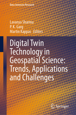
Digital Twin Technology in Geospatial Science: Trends, Applications and Challenges
暫譯: 地理空間科學中的數位雙胞胎技術:趨勢、應用與挑戰
Sharma, Lavanya, Garg, P. K., Kappas, Martin
- 出版商: Springer
- 出版日期: 2026-05-15
- 售價: $8,140
- 貴賓價: 9.5 折 $7,733
- 語言: 英文
- 頁數: 252
- 裝訂: Hardcover - also called cloth, retail trade, or trade
- ISBN: 3032203104
- ISBN-13: 9783032203106
-
相關分類:
地理資訊系統 Gis
海外代購書籍(需單獨結帳)
商品描述
This book explores utilization of digital twin technology and geospatial science for the digital transformation of urban planning, environmental monitoring, infrastructure, and disaster response using a series of present tools of data collection and applications. It covers transformational impact of digital twins, from their origin to their real-time applications in various domains. It presents real-time case studies focusing on real-world outcomes while addressing the potential risks. It also covers challenging issues related to geospatial twin technology and its solutions to handle relevant challenges. This book comprises several chapters that provide an overview of basic concepts from historical background and architecture twin technology with geospatial data, highlighting its capabilities for modeling, simulation, and optimizing complex systems. It also investigates the technical and ethical barriers to the widespread adoption of digital twin technology in geospatial science. It is a valuable source for students, engineers, professionals, researchers as well as organizations.
商品描述(中文翻譯)
本書探討數位雙胞胎技術和地理空間科學在城市規劃、環境監測、基礎設施和災害應對數位轉型中的應用,利用一系列當前的數據收集工具和應用。它涵蓋了數位雙胞胎的轉型影響,從其起源到在各個領域的即時應用。書中呈現了專注於現實世界結果的即時案例研究,同時討論潛在風險。它還涵蓋了與地理空間雙胞胎技術相關的挑戰性問題及其解決方案,以應對相關挑戰。本書包含幾個章節,提供基本概念的概述,包括歷史背景和結構雙胞胎技術與地理空間數據,突顯其在建模、模擬和優化複雜系統方面的能力。它還調查了數位雙胞胎技術在地理空間科學中廣泛採用的技術和倫理障礙。本書對學生、工程師、專業人士、研究人員以及組織來說都是一個寶貴的資源。
作者簡介
Dr. Lavanya Sharma earned her Ph.D. in Computer Science from Uttarakhand Technical University, India, in 2018, specializing in Digital Image Processing and Computer Vision, and her M.Tech in Computer Science in 2013 from MDU Rohtak. She is currently an Assistant Professor grade III in the Department of Information Technology, Research & Innovation at New Delhi Institute of Management, Delhi. A certified professional with over 20 certifications, including from ISRO, her research focuses on computer vision, motion-based object detection, and smart video surveillance. She has authored and edited 8 books, published over 90 research articles, and holds 8 patents in Computer Vision, Image Processing, Machine Learning, and Medical Imaging. Dr. Sharma has received several academic awards and has contributed extensively as a conference chair, reviewer, and academic leader, with research interests in Artificial Intelligence, Machine Learning, Deep Learning, IoT, Remote Sensing, and GIS, and a vision to advance teaching and research for societal development.
Prof. P K Garg worked as a Vice Chancellor, Uttarakhand Technical University, Dehradun (2015-2018). Presently, he is working in the department of Civil Engineering, IIT Roorkee as Emeritus Professor. He has completed B.Tech (Civil Engg.) in 1980 and M.Tech (Civil Engg) in 1982 both from the University of Roorkee (now IIT Roorkee). He is a recipient of Gold Medal at IIT Roorkee to stand first during M.Tech programme, Commonwealth Scholarship Award for doing Ph.D. from the University of Bristol (UK), and Commonwealth Fellowship Award to carry out post-doctoral research work at University of Reading (UK). He joined the Department of Civil Engg at IIT Roorkee in 1982, and gradually advancing his career, rose to the position of Head of the Department in 2015 at IIT Roorkee.
Prof. Martin Kappas received his PhD in Environmental Sciences/Climatology from the University of Mannheim in 1993. After his PhD Martin started a six year running "habilitation" program at the University of Mannheim to obtain the international "venia legendi" for Geography in 1998. Since 2000 Martin has been a University Professor of Geography and the head of the Cartography, GIS and Remote Sensing Section of the Georg-August University of Göttingen. His Remote Sensing laboratory is a full member of EARSeL (European Association of Remote Sensing Laboratories) and takes part as active member of DGPF (German Society of Geoinformation. Photogrammetry and Remote Sensing). His research interests are broad and include topics such as landscape evaluation using techniques of Geoinformatics and ground truth data collection (e.g. field spectrometry). His main research theme is the use of remote sensing and GIS to study land cover / land use change dynamics.
作者簡介(中文翻譯)
Dr. Lavanya Sharma於2018年在印度烏塔拉坎德技術大學獲得計算機科學博士學位,專攻數位影像處理和計算機視覺,並於2013年在MDU Rohtak獲得計算機科學碩士學位。她目前是新德里管理學院資訊科技研究與創新系的三級助理教授。作為一名擁有超過20項認證的專業人士,包括來自ISRO的認證,她的研究重點在於計算機視覺、基於運動的物體檢測和智慧視頻監控。她已撰寫和編輯8本書籍,發表超過90篇研究文章,並在計算機視覺、影像處理、機器學習和醫學影像領域擁有8項專利。Sharma博士獲得多項學術獎項,並在會議主席、審稿人和學術領導者方面做出了廣泛貢獻,研究興趣包括人工智慧、機器學習、深度學習、物聯網、遙感和地理資訊系統,並致力於推進教學和研究以促進社會發展。
Prof. P K Garg曾擔任烏塔拉坎德技術大學的副校長(2015-2018)。目前,他在印度理工學院魯爾基的土木工程系擔任名譽教授。他於1980年獲得土木工程學士學位,並於1982年獲得土木工程碩士學位,均來自魯爾基大學(現為印度理工學院魯爾基)。他是印度理工學院魯爾基的金獎獲得者,在碩士課程中名列第一,並獲得英國布里斯托大學的英聯邦獎學金以攻讀博士學位,以及英聯邦研究獎學金在英國雷丁大學進行博士後研究。他於1982年加入印度理工學院魯爾基的土木工程系,並逐步晉升,於2015年成為該系主任。
Prof. Martin Kappas於1993年在曼海姆大學獲得環境科學/氣候學博士學位。博士畢業後,Martin開始在曼海姆大學進行為期六年的「資格認證」計畫,以於1998年獲得地理學的國際「venia legendi」。自2000年以來,Martin一直是哥廷根大學的地理學大學教授,並擔任地圖學、地理資訊系統和遙感科學部門的負責人。他的遙感實驗室是EARSeL(歐洲遙感實驗室協會)的正式成員,並作為DGPF(德國地理資訊、攝影測量和遙感學會)的活躍成員參與活動。他的研究興趣廣泛,包括使用地理資訊技術和地面真實數據收集(例如現場光譜測量)進行景觀評估等主題。他的主要研究主題是利用遙感和地理資訊系統研究土地覆蓋/土地利用變化的動態。